


By Johnny Hughes - Elite Outfitters
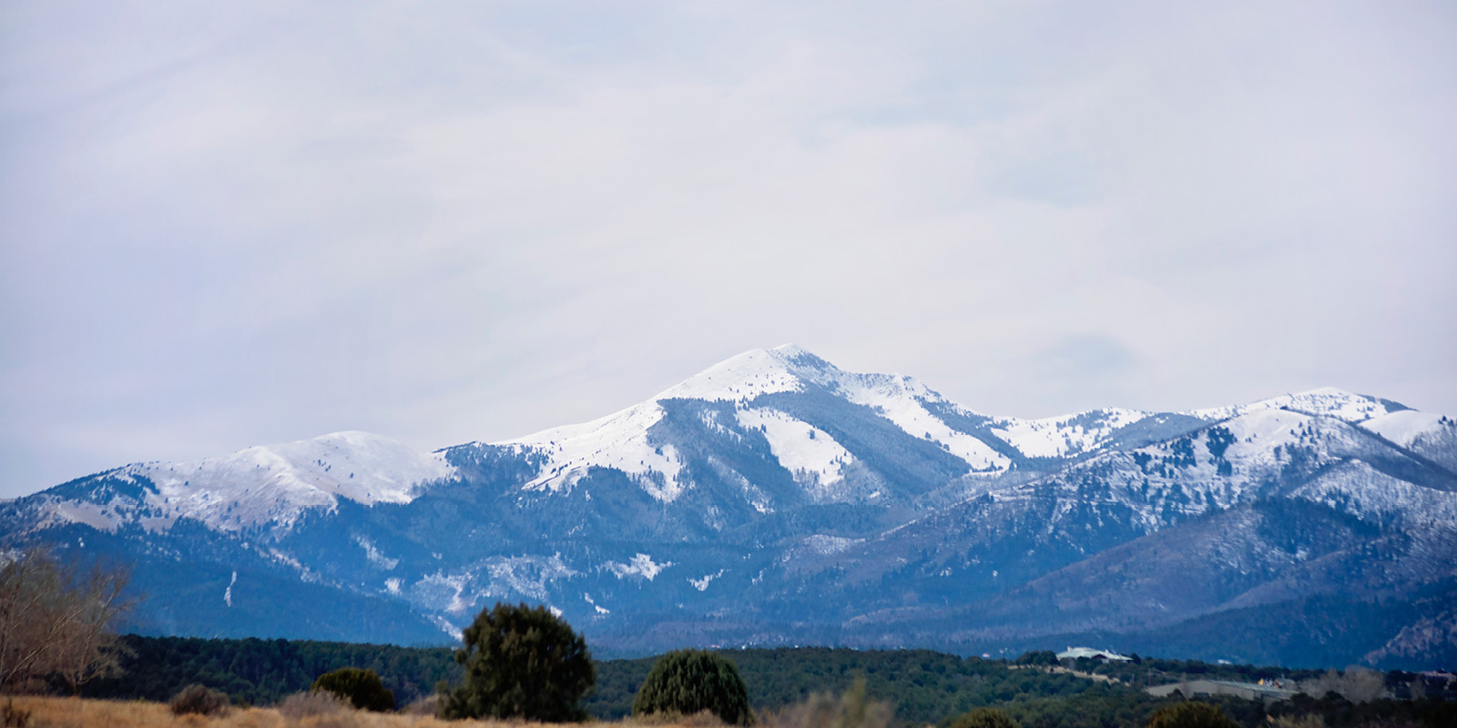
The Crest-Monjeau Trailhead provides access to the southeastern portion of the White Mountain Wilderness. This Trailhead provides the easiest access to the top of the mountains, and as a result, is one of the more popular hiking areas in the Wilderness. It is also the southern terminus of Crest Trail (#25). The Crest Trail extends to the northwest for 22 miles, ultimately ending at the Crest-Nogal Peak Trailhead. A shuttle vehicle is required to hike the entire Crest Trail.
Most hikers, who originate hikes from this location, are hiking the Crest Trail. Side trails usually drop quickly down into one of the canyons far below. Loop hikes are possible, but wise hikers will start loop hikes from the canyon bottoms where the last half of the hike is downhill.
The elevation of the Crest-Monjeau Trailhead is 9,250 feet.
Take Hwy 532 ( Ski Run Road) to the west off Hwy 48 in Alto. Go 1 mile and turn right onto Forest Road 117 toward Monjeau Peak. Go 4.5 miles and the trailhead parking lot is on the left just past Skyline Campground. Hwy 532 is paved and Forest Road 117 is improved gravel. Although rough in places, it is passable by car.
Crest Trail (#25) - Monjeau Peak to Nogal Peak
Trail Distance - 22 miles
Net Elevation Change - 7,700 feet (3,200 feet up, 4,500 feet down)
Highest Elevation - 11,200 feet
Hiking Crest Trail (#25) in a day is not feasible. It is best hiked over three days with a light pack. Although the trail follows the ridges for the most part, the up and down is brutal. The trail is well signed, and fairly easy to follow. Realize, hiking from Monjeau to Nogal Peak has less climbing than doing the reverse hike. Hiking the entire Crest Trail should be attempted by advanced hikers only.
Just past the Crest-Monjeau Trailhead, you will immediately reach the intersection with Rodamaker Trail (#18) and Telephone Trail (#16). These trails drop to Bonito Creek and Eagle Creek, respectively.
The remainder of the hike toward the ski area is mostly uphill. Scenic Trail (#15) drops to the ski area parking lot and is the first real chance to leave the Crest Trail. No water is present along the first 5 miles of the trail, so fill up before you leave.
A suggested first night’s camp is on the ridge above Ice Spring. The spring has excellent water and is actually the headwaters of the North Fork of Rio Ruidoso. At night, you can see the lights of Roswell 70 miles to the east. This location is over 11,000 feet in elevation.
The Crest Trail now descends almost 2,000 feet over the next 4½ miles. Some of the best scenery along the entire hike can be found on this stretch of trail.
Approximately ½ mile south of Elk Point, a spring is present beside the Crest Trail. A poly tube protrudes out of the ground and good water can be found here.
Just past White Horse Hill, the Crest Trail intersects with Aspen Trail (#35) and Three Rivers Trail (#44). Aspen Trail is your first chance to drop down to the Argentina/Big Bonito Trailhead. The Three Rivers Trail plummets 3,500 feet over 6 miles to the Three Rivers Campground, the only Trailhead on the west side of the range.
The next chance for water is Bonito Seep. The seep is located just past the sign marking the intersection with Big Bonito Trail (#36). It usually flows except during dry seasons.
Past Bonito Seep, all of the trails going off the east side of the range will end up at the Argentina/Big Bonito Trailhead. Most of the trails going off the west side will disappear and leave you hung out to dry.
A logical choice for a second night’s camp is at the intersection with Barber Ridge Trail (#49). A large, level camping site is present here. A semi-reliable spring is present about 75 yards northeast of the camping site in the head of the draw that drains down into Lincoln Canyon. Again, great in wet seasons, possibly dry during drought. There’s just not much water on top.
Argentina Spring is the last real chance for water. A log/fence enclosure is present here to protect a seep area from livestock. Just below it, there is a catch basin that usually has water. If not check the ¼ mile of Argentina Trail (#39) below the basin for more springs that are possibly flowing.
At Argentina Spring, Clear Water Trail (#42) makes a detour loop and comes back to the Crest Trail near Turkey Spring.
About 3 miles from the Crest-Nogal Peak Trailhead, Turkey Spring is reached. A log/fence enclosure is also present around a seep area. A stock water trough is present and usually has water. None is available for humans unless you’re really thirsty. Turkey Trail (#40) intersects the Crest Trail at Turkey Spring and it drops down to Road 107.
About 2 miles from the ending Trailhead, a signed intersection is reached. Tortolita Trail (#54) begins here and extends north along the west side of Nogal Peak and beyond. It’s followable but very rough. Skull Trail (#41) drops down Skull Canyon to the Road 108. Water Trail (#53) disappears into Water Canyon. You’re on your own there.
The Crest Trail finishes by sidehilling around the south face of Nogal Peak until it reaches the Crest-Nogal Peak Trailhead at Forest Road 108.