


Scenic Trailhead
By Johnny Hughes - Elite Outfitters
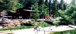
The Scenic Trailhead accesses the extreme southern portion of the White Mountain Wilderness Area. This Trailhead is the highest of any in the Wilderness (9,750 feet) and accesses the highest terrain (>11,000 feet). The Trailhead receives moderate use due to the proximity of a paved road, but provides the best look at an alpine ecosystem. A climax spruce and fir forest interspersed with alpine meadows provides a unique hiking experience.
The hiking is most suitable for novice to intermediate hikers. The trails are well maintained, signed, and easy to follow. The majority of the novice hiking opportunities is along Crest Trail (#25). Intermediate hikers looking for more adventure should look toward Lookout Mountain.
To reach the trailhead, take Hwy 48 north out of Ruidoso to the junction with Hwy 532 in Alto. Turn left onto Hwy 532 and go approximately 12 miles to the trailhead located at the entrance to Ski Apache. The road is narrow and winds considerably, but is paved the entire way.
Scenic Trail (#15)
Trail Distance - ½ mile
Net Elevation Change - 350 feet
Highest Elevation - 10,200 feet
Scenic Trail (#15) is the access trail to Crest Trail (#25) and Lookout Trail (#78) from the Scenic Trailhead. The Scenic Trail switchbacks through an alpine meadow where it terminates at the intersection with the Crest Trail. A sign marks the location.
Crest Trail (#25) - Scenic Trail to Ice Spring Segment
Trail Distance - 2½ miles
Net Elevation Change - 850 feet
Highest Elevation - 11,050 feet
The primary direction of travel on this segment of the Crest Trail is toward Ice Spring to the west. Hiking east along the Crest Trail is an option also, but crossing the Buck Mountain Road and the lack of views for over a mile make it less popular.
Once the Crest Trail leaves the Scenic Trail heading west, it passes through Douglas firs, subalpine firs, Englemann spruces and alpine meadows. The uppermost ½ mile of trail is opposite some of the upper runs of Ski Apache.
Ice Spring is a perennial spring that flows out of a crack in the rocks and provides an excellent place to get water. Ice Spring is the headwaters of the North Fork of the Rio Ruidoso.
Lookout Trail (#78) intersects with the Crest Trail at Ice Spring.
Camping locations are present on top of the ridge.
Lookout Trail (#78)
Trail Distance - ¾ mile
Net Elevation Change - 530 feet
Highest Elevation - 11,580 feet
Lookout Trail (#78) leaves Ice Spring and climbs slowly to the summit of Lookout Mountain at 11,580 feet. Lookout Mountain is the highest point in the Lincoln National Forest. The view to the south is of Sierra Blanca which towers to over 12,000 feet on the Mescalero Apache Indian Reservation. To the west, the floor of the Tularosa Basin sits over 5,000 feet below Lookout Mountain. White Sands and the Malpais Lava Flow can be seen on the floor of the Basin. The view to the north is the White Mountain Wilderness Area of the Sacramento Mountains. To the northeast, the Capitan Mountains highlight the distant skyline. If this view doesn't do anything for you I would suggest checking to see if you still have a pulse.
The upper portion of this hike is above the timberline and consequently you are exposed to the elements. Lightning from thunderstorms is an eminent danger in this area. Do not let yourself get caught on Lookout Mountain with thunderstorms developing.
Camping is available along the high ridge and the closest water is Ice Spring.


Copyright ©2024 RUIDOSO.NET | ALL RIGHTS RESERVED.